According to the Bureau of Meteorology the Gwydir and Namoi were still experiencing some of the driest conditions on record at the beginning of 2020. Since then, the area has seen a significant turnaround, receiving well above average rainfall over the past 12 months.
Dam levels and the river system in the Gwydir and Namoi have been well and truly replenished from the big rain events, which has significantly boosted agricultural production in the area. There’s a positive outlook for a bumper winter cropping harvest.
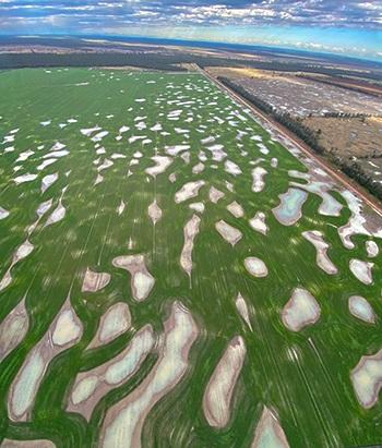
This photo was taken by Bryce Guest from North West Helicopters as he did a fly over the Namoi floodplain.
The depressions in the paddock are known as ‘gilgais’ or ‘melon holes’ and are caused by the expansion and contraction of soil. This farmer had to plant around the gilgais because they were too wet.
While there are still areas across the Basin in drought, it’s great to see some locations benefiting from much-needed rainfall.