The Paroo River catchment is in the top north-west corner of the Basin, with half of its area in Queensland and half in New South Wales.
The Paroo River begins in the Warrego Range, west of Charleville. From the range country, the Paroo flows across sparsely-populated semi-arid plains with little surface water. The river ends on the floodplains south of Wanaaring, in the top north-west corner of New South Wales.

Snapshot
| Catchment area | 3% of the Murray–Darling Basin |
|---|---|
| Contribution to Basin water | 2% |
| Annual stream flow | 445 GL (Calwarro gauge) |
| River length | 600 km |
| Tributaries | Beechal, Yowan and Qulberry creeks; part of the Cuttaburra Creek |
| Towns include | Eulo, Hungerford, Wanaaring |
| Major water storages | None |
| Water users | Stock and domestic |
The landscape and its water
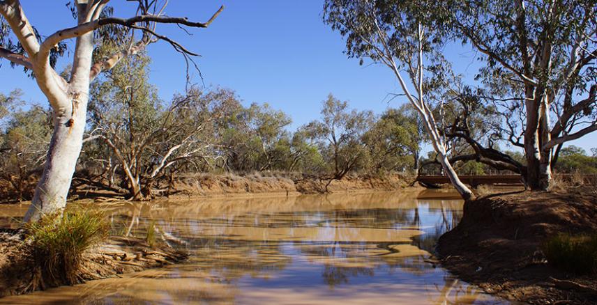
The Paroo is a series of waterholes, lakes and wetlands, some which remain permanently wet. With major rainfall, breakouts occur along the watercourses causing widespread flooding across the plains. In wet years, the lower Paroo receives flows from the Warrego River system via Cuttaburra Creek. In very wet years, the waters of the Paroo will flow to reach the Darling River, between Louth and Wilcannia.
The elevation of the Paroo's headwaters in the Warrego Range is around 330 metres. At the southern end of the catchment, the floodplains have an elevation of around 100 metres. Annual rainfall is low, with averages of 200–400 mm across the catchment. Most of the rain falls in the north of the catchment and occurs in summer and autumn. Evaporation in the region is high.
The Paroo region is underlain by shallow alluvial and sandstone aquifers. Shallow groundwater is generally saline and supply is unreliable. The deeper confined aquifers of the Great Artesian Basin also lie beneath the catchment, supplying the bulk of groundwater used in the region. Artesian springs are a feature through the region, including the Eulo artesian springs supergroup, which is a collection of more than 40 springs scattered in the area south-west of Eulo.
Living in the catchment
The Paroo catchment is home to few people – less than 0.1% of the population of the Basin. They live on large agricultural holdings or in small settlements such as:
Eulo
Hungerford
Cooladdi
Wanaaring
Tilpa
White Cliffs
Explorers passed through the region in the 1840s but it was not until the 1860s that pastoralists took up land, with livestock grazing only becoming viable thanks to demand from the goldfields and links to settled areas through river transport on the Darling. European settlement was along the river courses to ensure water supplies for people and livestock.
First Nations cultural heritage
The lands of the Paroo catchment have been important to First Nations people for over 25,000 years. Many First Nations people have a connection with the region, and their history, culture and livelihoods are intertwined with its river systems. The Paroo catchment includes (or borders) the traditional lands of the Bidjara, Budjiti, Gwamu/Kooma, Kunja, Mardigan and Murrawarri Nations.
Industry and agriculture
The income of the population comes from grazing of beef cattle and sheep for wool production, or associated employment, and retail and services to the local population. Goat production is a developing livestock industry in the region. There are few irrigated crops, and crop production is small – providing supplementary feed for livestock.
Tourism in the region is supported by natural attractions such as wetlands and national parks. Local government in the region is supporting growth in the tourism industry to diversify the local economy.
Opals are mined in the southern parts of the catchment, especially around White Cliffs.
Generally, groundwater resources within the region are of poor water quality and are not suitable for large-scale irrigation. Water from the Great Artesian Basin is a more reliable source for domestic and stock water. As a result, agriculture and industry uses little surface water or other groundwater in the region.
Regulation of water in the catchment
The Paroo River is mostly unregulated but some water is taken from the river by diversion of flow or overland flows. Water is held in weirs or large, shallow earthen storages located on the floodplain, known as 'ring tanks' or 'turkey nest' dams.
According to the 2016 Queensland water resource plan for the region, the Paroo catchment average end-of-system flow (assuming full usage of entitlements) is estimated to be just 1% less than the flows experienced in the system prior to any water resource development. At least 99% of the average 'without development' water in the Queensland section must flow into New South Wales. Because of this, development of water regulation resources is not likely in the foreseeable future.
Ecosystems
Lakes Numalla and Wyara within the Currawinya National Park are wetlands of international importance. Lake Numalla holds fresh water but Lake Wyara’s water is saline.
The region is a habitat for many animal and plant species, including a diverse range of waterbirds, as well as for many fish species, including a genetically distinct population of golden perch.
Yantabulla Swamp is part of the Cuttaburra Basin system, which covers more than 37,000 hectares and sources its water from the Cuttaburra Creek and Paroo River. It is the most important waterbird breeding site in north-west New South Wales.
Plants
Mulga scrub and shrubland are the main vegetation types on the plains of the Paroo catchment. Eucalypt and gidgee fringe the river and streams. The dominant eucalypt species in the catchment are river red gum, coolabah and poplar box.
In the lower reaches of the catchment many types of wetland vegetation are found, including:
black box
river cooba
grasses
forbs herbaceous flowering plants
River health
The Sustainable Rivers Audit 2 (2012) reported on rivers in the Basin.
Updated information about the health of specific rivers will be available when the Sustainable Rivers Audit 3 is undertaken. Funding to reinstate this program was announced as part of the October 2022 Australian Government budget.
See the Department of Climate Change, Energy, the Environment and Water October 2022 Budget fact sheets for more information.
The management of the water resources is the responsibility of local, regional, state and Australian governments.
Delivery to households, industry and farms is managed by local councils or regional water authorities.
State government departments for water ensures that the network of authorities manage water responsibly and fairly, catchment and waterway health is maintained or improved through catchment management authorities, and water saving, re-use and flood management projects are implemented. State governments must manage their state's water resources according to state and commonwealth water legislation.
In addition to directing operations of the regulated River Murray system, the MDBA implements a number of plans and programs to ensure the waters of the Basin, which flow through four states and one territory, are managed cohesively and in the best interests of all water users of the Basin.
Last updated: 24 June 2023