The Moonie flows from an altitude of 350 metres at its source on the Southern Downs, down to 150 metres where it meets the Barwon River. The Moonie is joined by 13 minor tributaries before merging with the Barwon, downstream of Mungindi on the flat expansive floodplain.
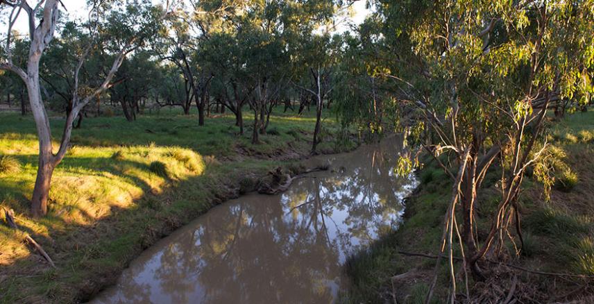
The Moonie River is a simple channel system with few tributaries compared with other rivers in the Basin. The river exists as a series of unconnected waterholes for most of the time, flowing about one third of the year.
Most of the catchment (98%) is in Queensland.

Snapshot
| Catchment area | 1.4% of the Murray–Darling Basin |
|---|---|
| Contribution to Basin water | 0.8% |
| River length | 542 km |
| Major tributaries | Teelba Creek |
| Towns include | Moonie, Thallon |
| Water storages | Thallon Weir (0.2 GL) |
| Water users | Stock and domestic, irrigation |
The landscape and its water
The Moonie catchment has a hot to warm semi-arid climate, with an average annual rainfall of 500–600 mm. There is considerable annual variation in temperature. As there are variations within years and between years in rainfall, the river flows are irregular and infrequent.
There are major shallow and deep groundwater aquifers in the Moonie catchment in the St George alluvium, and in sedimentary aquifers above the Great Artesian Basin. The sedimentary rock aquifers of the Great Artesian Basin, deep beneath the catchment, are also an important water source for the region.
First Nations cultural heritage
The lands of the Moonie River catchment have been important to First Nations people for over more than 25,000 years. Many First Nations people retain a connection with the region, and their history, culture and livelihoods are closely intertwined with its river systems.
The First Nations people of the area hold the Boobera Lagoon to be the resting place of Garriya, the Rainbow Serpent. The lagoon is significant to the Bigambul and Kamilaroi people who held the third stage of their joint male initiation ceremonies there. Today Boobera Lagoon is recognised as a culturally-significant site and motorised water sport is prohibited on the lagoon.
The catchment includes the traditional lands of the following nations:
Bigambul
Mandandanji
Gomeroi/ Kamilaroi
Living in the catchment
The Moonie River catchment is sparsely populated, with less than 0.1% of the population of the Basin living in the region.
European settlers first arrived in the Moonie region in the 1840s, attracted to the pastoral country and climate suitable for grazing sheep and cattle. Australia’s first commercial oil field was established in 1961 near the town of Moonie and is still operational.
There are no major towns in the Moonie catchment. The population is less than 2,000 people scattered in rural areas and distributed amongst a few small settlements such as Moonie and Thallon. The closest town to the Moonie region is St George, which has over 2,500 people. The nearest large urban centre is Toowoomba on the edge of the Basin, with a population over 150,000. Agriculture is the most significant employment sector in the catchment.
Agriculture and industry
More than 70% of the catchment is used for grazing, mainly beef cattle, on native and improved pasture. About 10% of the land is used for dryland cropping and about 15% is native vegetation. There is a very small area of irrigated crops in the west of the catchment, mainly cotton, which accounts for about 90% of water use in the region.
Almost all irrigation in the region depends on surface water. However, these diversions are small, accounting for only 0.2% of surface water diverted for irrigation in the Basin. Groundwater use is less than 0.1% of the Basin total, excluding water from the confined aquifers of the Great Artesian Basin, which provides around 70% of the groundwater used in the region.
Regulation of water in the catchment
The Moonie River is a predominantly unregulated system and has no water major storages. A weir was built over the river at Thallon in 1959 to supply town water.
Small to medium weirs are dispersed along the river for irrigation purposes, predominantly for cotton. The majority of water stored is harvested through capture of overland flows and the diversion of floodwater during episodic flow events. Water is stored in large shallow floodplain storages known as ‘ring tanks’ or ‘turkey nest dams’.
Ecosystems
The Moonie catchment is ecologically significant as it flows through the endangered southern brigalow belt, which contains remnants of brigalow forests, poplar box, wilga and white cypress pine. The Moonie River system has more than 100 floodplain wetlands, many of which support bird breeding, and includes biodiverse and unique in-stream systems.
The catchment provides habitat to several protected species of birds, including the Australian painted snipe and the freckled duck. It contains threatened and endangered plant species and three endangered vegetation communities.
The Thallon Waterholes, while not formally recognised as nationally or internationally important, are significant for waterbirds in the Basin. The waterholes include 2 relatively permanent lakes of approximately 12 and 21 hectares, which are filled by overbank flows during floods and provide habitat for a range of aquatic organisms and up to 20,000 waterbirds.
The catchment is heavily cleared and impacted by agricultural development, with eroded banks and riparian zones.
River health
Read about specific rivers on the Sustainable Rivers Audit (2012). Updated information about the health of specific rivers will be available when the Sustainable Rivers Audit 3 is undertaken. Funding to reinstate this program was announced as part of the October 2022 Australian Government budget.
See the Department of Climate Change, Energy, the Environment and Water October 2022 Budget fact sheets for more information.
Last updated: 24 June 2023