This update provides an overview on how the Murray–Darling Basin Authority is managing Hume Dam and Dartmouth Dam during the current high flows.
The regular update includes:
- catchment conditions
- forecast rainfall and inflows
- water releases
- planned management for the coming week.
Catchment conditions
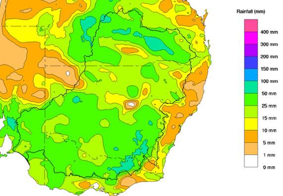
For the week of 6 to 12 September the rainfall for Victoria and southern New South Wales was largely above average. Soil moisture levels increased slightly due to recent rain and continue to be above average for this time of year.
Forecast rainfall and inflows

The Bureau of Meteorology is expecting rainfall totals to 19 September to be potentially in the range of 50–100mm for parts of the Upper Murray region.
The 7-day forecast map is automatically generated and subject to change daily when the models are run.
The Bureau of Meteorology is the best source of information to stay up-to-date with more detailed forecast rainfall and flood information.
The outlook for the next 2 weeks shows a high chance of above-median rainfall for this time of year. The outlook for spring shows a similar picture with a high change of above-median rainfall.

The status of the Bureau of Meteorology’s El Niño–Southern Oscillation Outlook has been raised to La Niña. The Bureau reports that models are indicating this La Niña event may peak during the spring and return to neutral conditions early in 2023. La Niña events increase the chances of above-average rainfall for northern and eastern Australia during spring and summer.
In addition, the negative Indian Ocean Dipole (IOD) event continues and is likely to continue into late spring. A negative IOD event is typically associated with above average spring rainfall for much of Australia.
Snapshot: Dartmouth and Hume

Dartmouth Dam and Hume Dam this week
Flood operations are being conducted at both dams.
Useful airspace volumes are currently available in each dam however the focus remains on generating more airspace to assist in mitigating the impact of future high rainfall events.
Rain is forecast from Thursday 15 September 2022. The MDBA remains in contact with the Bureau of Meteorology about the likely total rainfall and inflows and the timing of this event.
At Dartmouth Dam there is a chance water will go over the spillway because of this rainfall event. The MDBA continues to release water from the dam to target flows at Tallandoon within the river channel. Releases will be reduced ahead of possible inflows from the Mitta Mitta River tributaries.
Inflows to Hume Dams are receding after last week’s rain, and airspace is currently being generated.
Flows at Doctors Point near Albury are around 40,000 megalitres per day. There is potential for a rise in flows from the Kiewa River in coming days and if required, Hume Dam releases may be reduced to accommodate the rises, as occurred last week. The situation will continue to be monitored and action taken based on rainfall and inflows observed and forecast.
Are you flood ready?
If you live, work or holiday on a floodplain, be prepared
Develop your personalised flood emergency plan for your home and property
www.ses.nsw.gov.au
www.ses.vic.gov.au/plan-and-stay-safe
All residents can sign up for the Early Warning Network to be notified about Hume Dam release activities during periods of flooding or high releases
www.waternsw.com.au/supply/ewn
Check the BoM website to receive the latest weather and flood information and warnings in your area
www.bom.gov.au/australia/flood
www.bom.gov.au/australia/warnings